
Regional Geological Setting of Project Area
The Project Area lies entirely in the Sarung khola Formation of Higher Himalayan rocks. The Thrust and faults in this region lies somehow nearfrom the Project site but has not got any significant effects. Regionally, this zone consists predominantly of high grade metamorphic Precambrian rockmass, comprising of various schist, quartzites and gneisses.The Regional Geological map of the Project area is presented above in Figure 5.2.
5.3 Geomorphology
Geomorphologically, Nepal is divided into five principal morphological regions, which are a reflection of the underlying geology and are continuous as linear belts throughout the entire length (EW) of the country.
- Tibetan Plateau
- High Mountains
- Middle Mountains
- Siwaliks (Churiya)
- Terai Plain
A brief summary of the physiographic description is presented in the following sections to provide the background setting for discussion on the geological conditions of Project site. These five zones are briefly described as follows:
The Tibetan Plateau consists of the mountain ranges between 3000m, amsl and 5000m, amsland comprises Tethys sediments represented by fossiliferous sedimentary rock such as shale, limestone, dolomite etc. In the vicinity of the Project area this zone is not observed. Tibetan plateau is separated from the Higher Himalaya (HH) belt through South Tibetan Detachment System (STDS).
The High Mountain region is characterized by culminating peaks, which form the backbone of the mountain chain stretching along the entire northern border of Nepal. In Nepal this region has the world’s highest peak, the Mount Everest, and more than half a dozen of other peaks exceeding 8000m, amsl. The region is characterized by the deeply entrenched valleys.Geologically, the southern boundary of the HighMountains is the Main Central Thrust (MCT). This region consists of northerly dipping Precambrian high-grade metamorphic rocks overlying the Precambrian basement.
In between the Main Central Thrust (MCT) to north and the Main Boundary Thrust (MBT) to south lies the broad belt of the Middle Mountains. Geologically, the MBT separates Middle Mountains from the Siwalik (Churiya) range to south and the MCT from crystalline rocks to north. The average width of this zone is 60 kilometers and characterized by mountains of the Mahabharat Range in south. Peaks up to 3000m are common in the Middle Mountains. The landscape of this zone is matured with smooth uniform slopes, which have been dissected by actively eroding rivers rejuvenated with the recent uplift of the Himalayas. It consists of meta-sedimentary rocks, in between which thrust slabs of gneiss and high grade metamorphic rocks are present as observed in the Project area. This zone is folded and faulted and terminated in south by the MBT, along which it has been moving southwards since the Pliocene time.
The varied geological structures and rock types give rise to irregular high relief terrain showing short ridges, deep gorges and dissected mountains. River terraces are particularly conspicuous, especially in the long strike valleys, such as the Arun valley. The trend of the ridges is in conformity with the strike of gneissic rocks. Cliffs and escarpments are frequently observed therein. They are formed by gneiss, quartzite and slatyphyllite. The rocks of Middle Mountains are characterized by the Lesser Himalayan rock sequences which regionally dip towards north.
Bordered in north by the Main Boundary Thrust (MBT) and in south by the Terai (Indo-Gangetic) plain, the Siwalik (or Churiya)are formed exclusively by molasses sediments. The Siwaliks dip regionally towards the North and are represented by sandstone, mudstone and conglomerates.
They usually form strike ridges and valleys. Within the Koshi basin the MBT is a well-defined topographical trench which may be traced across hills and valleys alike. Landslides in the Siwalik formation are common; generally onthe north facing dip slopes and severe erosion characterizes the scarp slope, particularly in the upper part of the sequence. Elevations in this zone range between 600m, amsl and 1300m, amsl. The Siwaliks (Churiya) are bounded to south by a series of discontinuous thrusts known collectively as the Himalayan Frontal Fault (HFF) or Main Frontal Thrust (MFT). These structures are poorly exposed on the surface, yet sufficient evidence exists to regard them as important currently active regional structures.
This zone forms the narrow southern fringe of the country and is bordered to north bySiwaliks (Churia). Beyond Siwaliks (Churia), towards south the Terai Plain falls within Gangetic basin. The Terai Plain comprises of alluvial and colluvial fans spread out at the toes of Siwaliks with progressively finer material being deposited downstream.
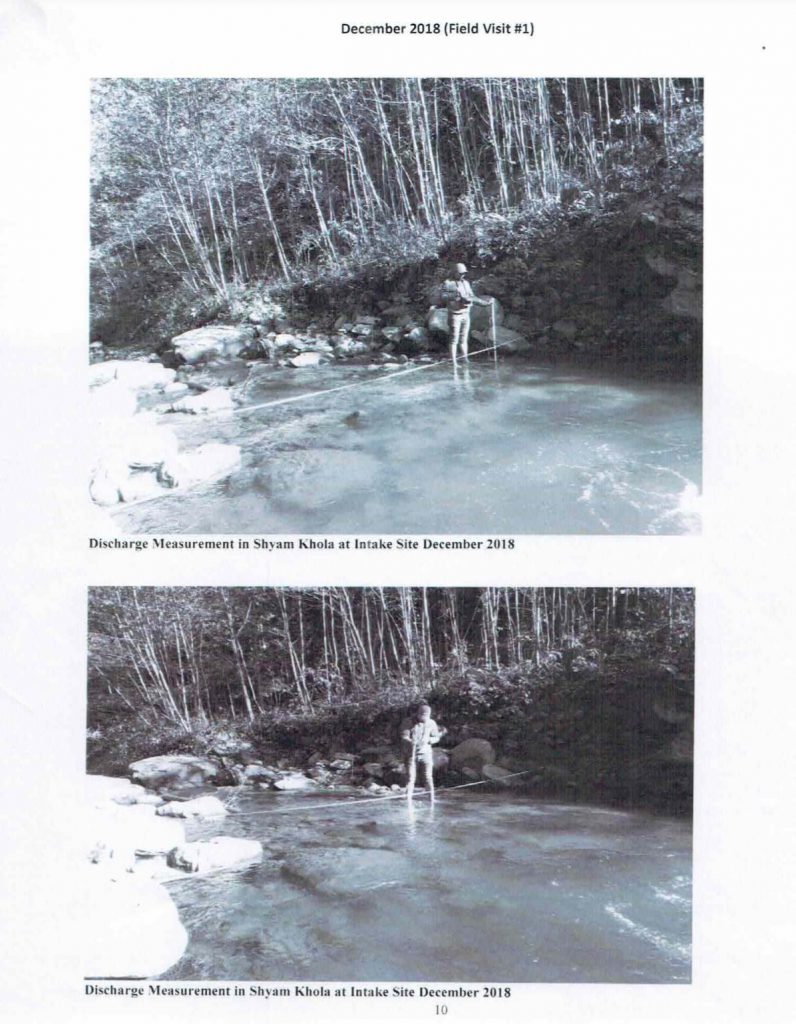
The Shyam khola is the one of the tributaries of the Arun river originating within the middle and high mountains located at the District. The Shyam khola in the project vicinity is generally wide and highly sediment laden with some narrow channel at places.It originates from the eastern watershed region accompanying parts the districts. Its main tributary is Lamuwa khola.
The entire length of the river channel is filled up with the recent alluvium derived by the river itself. In most of the areas, the banks on either side of the river are covered by mixed alluvio-colluvial deposits. The higher terraces at the banks of the Shyam khola are accompanied by colluvial deposit. The hill slopes around the river valley is steep to moderately steep and somewhere quite gentle and firm slopes as well. In most of areas, bedrocks are poorly exposed.
The highest elevation within the project area is about 1750m amsl and the lowest part lies at about 940m amsl. The morphology of the surrounding catchment area of the Shyamkhola in the vicinity of the project area seems to be more or less stable although steep slopes can be found at parts and the presence of moderate to gentle at the northern hills and mild slope consisting of argillo-arenaceouscolluvial deposits which are well covered by thick vegetation and patterned cultivation makes the area stable.
 Users Today : 0
 Users Last 7 days : 70
 Users Last 30 days : 361
 Users This Month : 277
 Users This Year : 1967
 Total Users : 11236
 Views Yesterday : 48
 Views Last 7 days : 199
 Total views : 36123